Planning a Tahiti hiking adventure? This is your guide to all the island’s amazing hikes.
Tahiti is usually a layover spot for travelers. They often spend a day in Papeete and then move on, missing out on exploring the natural side of Tahiti with its jagged mountains and lush landscapes.
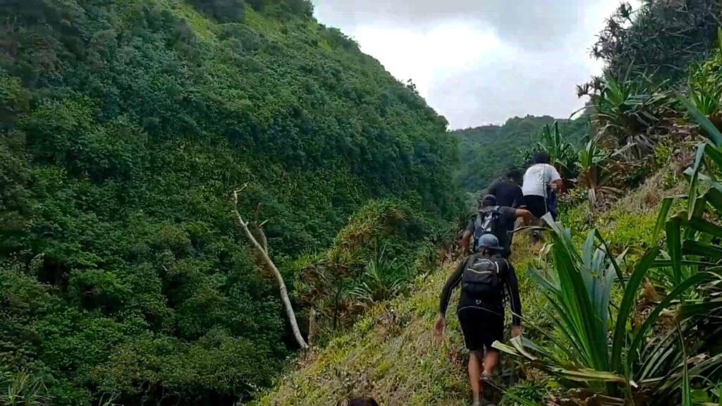
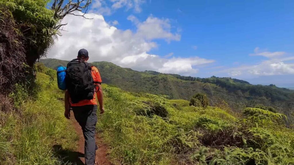
There are plenty of trails in Tahiti that lead to hidden waterfalls, breathtaking views, and peaceful nature spots. Some trails are short and easy, perfect for beginners, while others are longer and demanding, ideal for experienced hikers looking for a challenge.
So when planning a trip to French Polynesia, make sure to add an extra day to your itinerary to explore Tahiti’s inland beauty.
In this hiking guide, we’ll talk about all the best hikes in Tahiti and beyond, so you can find the right one for you and set off for an incredible hiking adventure.
Top Hiking Trails in Tahiti
1. Mount Aorai Hike
- Length: 9.5 miles
- Difficulty: Hard
- Elevation: 2066 meters
Mont Aorai is the third highest mountain in Tahiti with an elevation of approximately 2066 meters. The hike to Mount Aorai is quite long (about 7.6 miles) and challenging. It normally takes around 10 hours to go out and back.
Trailhead is located in Pirae commune near the O Belvedere restaurant. The road to the restaurant is narrow but paved. It takes around 20 minutes to get there from Papeete city.
At first, the trail looks flat and easy but as you continue your journey, it gets narrow and overgrown with foliage. The path until the first refuge is relatively easy with some steep and tricky parts but nothing unmanageable. It’d take a couple of hours to get to the first refuge.
From the first refuge, the hike gets intense with narrower, steeper, and scrambling sections. There are spots with sharp drop-offs that can make you dizzy if you look down. The good news is there are ropes to hold on to, and the views get better as you ascend.
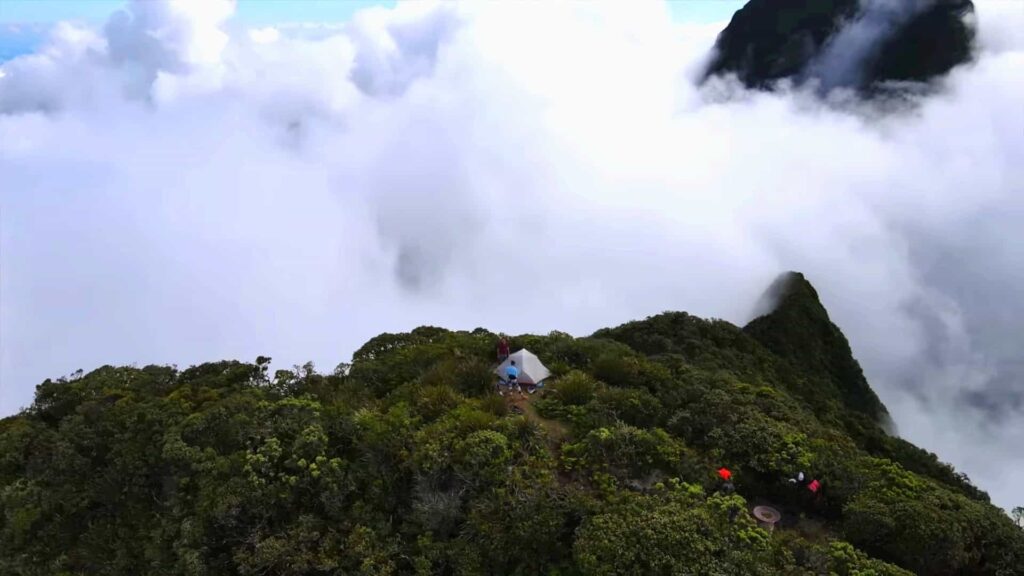
After an hour of hiking, you’ll reach the second refuge at 1800 meters. This is where you can take a break, relax or even spend a night if you want. These campsites have no facilities except water. So bring your stuff along if you plan to do this hike overnight.
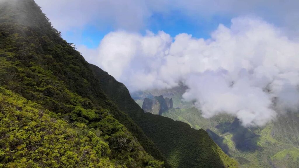
From the second refuge, the summit is about 2 km away. At the top, you’ll be above the clouds and have breathtaking views of the Tahiti mountains and the Pacific Ocean.
This hike isn’t for the faint-hearted since most of the trail runs along the ridge. It’s only recommended for avid hikers, if you’re not a pro, you should probably stop at the first refuge.
Also keep in mind that it usually gets cloudy up there, so choose a clear day to avoid obstructed views.
2. Papaiona – Green Peak
- Length: 4.7 miles
- Difficulty: Moderate-Hard
- Elevation: 1120 meters
Papaiona – Green Peak hike is perfect for anyone looking for a quick getaway from Papeete’s hustle and bustle. It’s about 4.7 miles long and takes less than 2 hours to get to the top, which is over 1100 meters high.
The hike can be divided into two parts. The first part up until the forest is pretty easy with a nice and clear path. After that, it gets harder with some steep climbs, and slippery spots you gotta watch out for. Toward the end, you exit the forest, and if it’s not cloudy, the sun will totally beat down on you.
During the hike, you’ll pass through the areas where ferns can scratch you badly, so wear long pants and long sleeved shirts.
The hike isn’t boring because as you climb higher, the views gets better and better. You’re surrounded by the lush landscapes of Tahiti, and if you roll your eyes to the west side, you’ll have a bird’s eye view of Papeete city. You can even see the peaks of Moorea in the distance calling for another hiking adventure.
In order to get to the hike starting point, head to Mamaias housing estate (Les Mamaias) in Faa’a and look for the forest. If you can’t find it, you can ask the locals about the Green Peak trail.
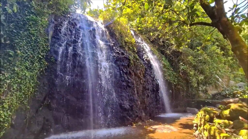
3. Cascade de Loti (Fautaua Waterfall)
- Length: 7 miles roundtrip
- Difficulty: Moderate
- Elevation: 450 meters
Cascade de Loti is the famous waterfall in the Fautaua Valley of Tahiti. The full hike to the waterfall is about 3.6 miles long and can take 2-3 hours, depending on your pace.
Before you hit the trail, make sure to grab a permit from the city hall (Mairie de Papeete) which costs about $5 for an adult. Show this to the guard and he’ll let you through.
Your trekking journey starts from the parking lot, where you’ll follow a flat, wide path for about 1.5 miles. Once you reach the bridge, you’ll have two options, to take the upper or bottom trail. The upper trail is a kilometer more walking and steeper than the bottom trail, but has better views. The bottom trail is muddy and gets challenging in some areas where you’ve to cross the river.
Both the trails wind through the jungle – there’ll be mosquitos and flies ready to attack you, so don’t forget to bring a bug repellent. Trails are not well marked, and routes can get confusing at some points. I’d suggest downloading the trail on your phone so you stay on course.
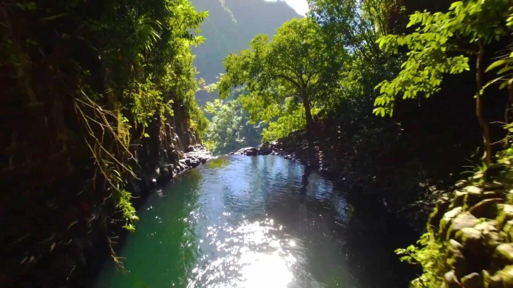
If you take the bottom trail, you’ll pass a few small waterfalls and streams along the way. The upper trail has two pools with waterslides at the end, which make you forget all the effort it took to get up there.
The Fautaua Waterfall has a height of about 400 feet. And it’s absolutely stunning!
4. Apostles Trails (Mission Hike)
- Length: 5 miles
- Difficulty: Moderate
- Elevation: 675 meters
If you’re looking for a hike in Papeete that is short and not too difficult, then try the Apostles Trail. The trailhead’s at the end of Pureora Street in Papeete – just look for the metal chain and start from there. It’s a popular trail, you’ll probably run into other hikers as well.
Apostles Trails also known as the Mission Hike is a 5 mile loop trail that takes around 3 hours to complete. The trail is not that difficult since it mostly goes through the dense forest with dry paths and some slippery sections. If it rains, the trail gets a lot more slippery and challenging. So if you’re gonna hike after the rain, you’ll want to wear mud shoes.
When you descend into the jungle, the trail splits in two. The left path is pretty straightforward but slippery, while the right one is dry, twisty and a mile longer. Near the end, both routes merge into one narrow path. You’ll also run into some gnarly ferns ready to scratch you up, so long pants are recommended.
The views at the end are nice but if you go a little further uphill, you get even better views of lush valleys and mountains of Tahiti.
5. Mont Marau Hike
- Length: 5.6 miles
- Difficulty: Moderate
- Elevation: 1441 meters
If you’re looking for a long and easygoing hike, then you should hike up to Mont Marau. The mountain is located on the west of Tahiti in Fa’a’ā. You can find the trailhead near Lotissement Miri, in Puna’auia. There’s plenty of parking space nearby where you can easily park your car and start walking from there.
Hike to Mont Marau is 5.6 miles long gradual ascent that can take around 3 hours to reach an elevation of over 1400 meters.
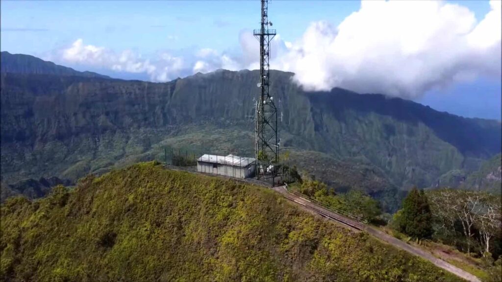
There are multiple trails that go up to Mount Marau. The main 4×4 trail is most commonly used by hikers and mountain bikers. It’s flat but rocky, and there’s very little shade, so bring sun protection.
On the other hand, if the weather is cloudy, you’ll be safe from the hot sun but then clouds up there can block your views and you may not be able to see the beautiful scenery around. In that case, I wouldn’t recommend taking the hike as it’d be boring.
On a good day, you can catch breathtaking views of Tahiti’s landscapes, including Mount Aorai from the top.
6. Vaipahi Great Loop to River
- Length: 3 miles
- Difficulty: Moderate
- Elevation: 304 meters
Vaipahi Great Loop is one of the beautiful hikes in Tahiti with incredible viewpoints and waterfalls along the way. It’s recommended for everyone, young, old, so to say anyone who’s in decent physique.
The trail is a loop that’s 3 miles long and takes less than 2 hours to cover to its entire distance. It starts from the famous Vaipahi Water Gardens.
Actually this isn’t the only trail there, there’s also another trail (river trail also known as blue trail) which is shorter and takes about 30 minutes for a roundtrip. If you’re looking for a quick in and out, choose the river trail otherwise go for the great loop trail which also covers the river trail.
There’s a map displayed at the start of the trail which shows the routes. In addition to that, there are trail marks throughout the hike pointing you the right way.
At the beginning, the trail starts off with an uphill climb to get your legs warmed up. Then it’s a gradual incline on a nice wide, flat path that’s great for both hiking and running. On your way up, you’ll go through a pretty pine forest with some awesome views.
At the pass, you can follow the west loop for more uphill climb and better views from the top and then return, or you can turn around from the east loop.
The East loop also connects to the river trail which is a bit more challenging section. Most of the trail has solid footing but there are a few steep and slippery sections, plus a river crossing. There are ropes to help in tricky spots, so that’s good.
The trail overall is totally worth the effort for the beautiful plants, waterfalls and scenic overlooks along the way.
7. Mount Orohena Hike
- Length: 9-12 miles
- Difficulty: Demanding
- Elevation: 2241 meters
Mount Orohena is the highest peak in French Polynesia reaching a height of 2241 meters (7352 feet). It’s also the second highest peak in all of the South Pacific after Mount Popomanaseu.
The mountain is situated in Mahina commune just around the center of Tahiti. You can find the trailhead north of the island in Mahina near Papeete.
Mount Orohena Hike is one of the most challenging and longest hikes in Tahiti. It’s about 9-12 miles long and can take around 6 hours to reach the summit. You could even turn this into a multi-day hike since you’ll probably need to camp and rest along the way. So bring enough snacks and water.
The hike contains a rough overgrown terrain with many steep ascents and descents. The first part of the hike mostly involves uphill climbing, then it’s a ridge walk up to the top with steep drops on each side. Although ropes are available to help you out, but this hike is no joke and not for novices or the faint-hearted. It’s a technical hike, and only recommended for seasoned hikers.
During the hike, you’ll also pass through Pihaiateta (at 1742m height) and Pito Iti (at 2110m height) peaks. These peaks are usually camping spots for hikers.
From Pito Iti, you can have incredible views of Punanuea Valley and mountains, you can also see Orohena summit which is right in front. The hike only gets difficult from this point with sharp & steep ridges that’ll make your heart race.
Reaching the summit is quite an achievement, you are kinda like on the roof of Tahiti from where you can see all of Tahiti and the Pacific Ocean spread out.
8. Marae Arahurahu trail
- Length: 1.9 miles
- Difficulty: Easy
- Elevation: 160 meters
Marae Arahurahu is an ancient religious site that holds great significance to Tahitians culture. It’s right by the Rohto Beach in the Paea district on the west of the island. If you’re driving by the area, you’ll see a sign on the main road pointing towards the site.
Besides checking out Arahurahu site, the trail here offers a fun little adventure out in the woods. It is kind of a hidden gem as it hides right behind the marae.
The trail is short and easy – good for anyone who’s in decent shape. It’s about 1.9 miles in length and would take about an hour to get to the top, which is around 160 meters up. However, it isn’t clearly marked, and you can easily get off the track, so make sure you’ve got trail map before you start trekking.
The trail from Marae Arahurahu isn’t really a hike. It’s more like a jungle walk on a rough, rocky path with some bushwhacking. There’s also a river mid-way that you have to cross to continue. It can get hot if you hike during the day, but the path is mostly shaded by tree canopies which keep the temperature from rising too high.
At the end, the trail is barricaded which is a bit disappointing but it’s because of private property, so you’ll have to turn back. At least you still get some nice forest scenery.
9. Heights of Vaiatu Paea
- Length: 5.6 miles
- Difficulty: Easy
- Elevation: 654 meters
Heights of Vaiatu Paea is a fairly easy 5.6 miles hike that gains about 650 meters of elevation. It usually takes around 3 hours to complete the round trip.
The hike is on the west side of Tahiti, in the town of Paea. Once you’re there, look for Vaiatu Public Elementary School, which is close to the trailhead. You can park at the school and start your hike from there.
The hike kicks off with a steep climb and then eases into a gradual incline on a nice wide path. The trail is shaded most of the way with a few exposed and overgrown sections. You might be disappointed at first as there aren’t many views until you reach the loop.
There’s also a little trail midway through the loop that you shouldn’t miss. It leads to a ridge where fantastic views of the valley, blue ocean, and Moorea are waiting for you. It’s definitely worth the extra effort.
10. Te Pari
- Length: 6 miles
- Difficulty: Moderate
- Elevation: 112 meters
Te Pari Cliffs offers one of the most adventurous hikes in Tahiti. It’s located in the southeast of Tahiti Iti near Teahupoo, far from the main island.
To reach Te Pari, you’ve got two choices: either hop on a boat or walk the tough Fenua Aihere/Eihere hike, which can add an extra 2-3 hours to your Tahiti hiking journey. So the best option is to go by a boat or book a guided tour.
The trail is rough and rocky with many steep climbs along the way. It’s about 6 miles long and could take around 3 hours to reach the top, which is about 112 meters high. Not super high though, but still a good workout.
The hike is moderately difficulty but can get tricky if the terrain is wet. The good thing is that there are ropes in a few spots for assistance. The trail takes you through the tropical forest, lush valleys, stunning lagoons and along the coast. You’ll also come across beautiful waterfalls, and cliffs you can jump off into the water.
The breathtaking views you see throughout the hike and the experience you get on this trek altogether make this hike worthwhile.
11. Mahinarama Trail
- Length: 7.2 miles
- Difficulty: Moderate
- Elevation: 457 meters
If you’re looking for a peaceful outdoor adventure with your loved ones, or say a family hike, then the Mahinarama Trail is a perfect pick. Trailhead is easily accessible as it’s just off the main road, near the Super Marché Mahina, so it’s easy to get to.
The trail starts off easy, but the distance will definitely give you a good workout. It’s about 7.2 miles which normally takes around 5 hours for a roundtrip. The trail takes you to an elevation of 457 meters.
Most of the path is well defined and is shaded by trees, but it can still get quite hot on a scorching day, so bring along at least 1.5L of water per person.
In rainy conditions, trail becomes very slippery, so wear mud shoes or try avoid hiking. Light rains are usually fine though.
At the end of the trail, you’ve amazing views of Tuaura Valley and Mahina district with its blue lagoon.
12. Atiue (Plateau vaitavere)
- Length: 8 miles
- Difficulty: Moderate
- Elevation: 1062 meters
If you are looking for a morning or evening hike in Tahiti, the Atiue hike is a great option. The trail is mostly exposed with almost no shade. On a hot day, the sun can be intense and you’ll be exhausted pretty quickly. So it’s best to do this hike in the morning or evening.
The hike is about 8 miles long and normally takes around two and a half hours to reach the summit, which sits at an altitude of 1084 meters.
The hike begins on a well-paved road that continues for a few miles before turning into a wide dirt trail. As you make your way up, the trail becomes narrow, and overgrown with foliage near the end. You’ll also encounter waist-high ferns that might be wet and scratchy.
At Belvedere, there’s flat, grassy ground where you can lie down, relax or even set up a picnic. The views from the top are absolutely stunning no matter where you look. On one side, you’ve got the beautiful Punaruu Valley, and on the other, the majestic Mount Marau.
Overall the hike isn’t that difficult as the trail is mostly in good condition, but you might not like its steep and slippery character especially if the terrain is wet. So good hiking shoes and some hiking expereince is recommended.
You can locate this hike in Puna’auia near the Primary School Manotahi. Once there, you can start your hike either from the parking lot or drive up to the Vaitavere cemetery to save a 2 mile walk.
13. Vaihi and 7 waterfalls hike (Vaihi de Hitia’a)
- Length: 3.9 miles
- Difficulty: Moderate
- Elevation: 276 meters
Many people visiting Vaihi Waterfalls don’t know that there are 7 other waterfalls in this area. They are further along the trail beyond the Vaihi Waterfalls.
The trail from the Vaihi Waterfalls is about 3.9 miles long and takes you through the tropical rainforest, along rough paths with lush vegetation. It can take more than 2 hours to reach the last waterfall at the top.
The hike starts off easy, but gets difficult as you go along. It’s also not well marked, but there’s a stream that runs next to it, so if you follow the stream, you’ll likely be on the right track. It’s also a good idea to have a guide along for a safer and more fun experience.
Even though the hike is shorter and easier compared to other Tahiti hikes, it can still make you sweat. The good thing is that the trail is mostly shaded, and there are several basins and waterfall pools along the way where you can take a refreshing dip. So don’t forget to bring your swimsuit!
Near the end, you’ll be fully exposed to the blazing sun with no shade. But once you reach the top, you’re rewarded with breathtaking views of the island’s eastern side, the Pacific Ocean, and Motu Nono.
Make your Tahiti trip easier with these helpful services!
Explore the best tours & activities
Find your ideal accommodation
Best time to go hiking in Tahiti
You can go for a hike at any time, except when the weather is bad. Season-wise, the dry season from April to November is the best time to hike in Tahiti. This is when the weather is usually pleasant with mild temperatures and mostly clear days, making it perfect for outdoor adventures.
Don’t forget that Tahiti is in the tropics, you’ll always feel some heat and humidity no matter which time you hike. However, the hiking experience is better during the dry season than at other times.
Tahiti Hiking Essentials & Safety Tips
Wear good hiking shoes
Most of the trails in Tahiti often have steep and slippery sections. Even if they appear flat at first, there’s usually a tough part ahead at some point. So it’s recommended that you wear hiking shoes rather than flip flops.
If you’re hiking in wet conditions, definitely consider wearing mud shoes.
Protect yourself from sun
Sun in Tahiti can get pretty fierce. You’ll need sunscreen to protect you from getting burned by the sun. Additionally, a sun hat and sunglasses will be extra protection, especially on exposed trails.
Wear long pants
Many of the Tahiti hikes go through bushes and ferns, which can scratch you and cause itchiness and infection. To stay safe, wear long pants and long sleeved shirts for protection.
Don’t forget to pack a bug spray
You’ll need a bug spray in Tahiti especially when going through forest and vegetation. This is one of the must-haves for hiking in Tahiti.
Bring snacks and water
Because Tahiti’s climate is hot and humid, you’ll sweat a lot during hikes. Bring at least 1 liter of water per person for a 4 mile hike. And don’t forget to bring snacks along on longer hikes.
Download offline-maps
While signal reception will be fine on most of the hikes on the island, it’s always a good idea to have an offline version of the trail map on your phone.
Bring necessary hiking gear
Before you head out, make sure you’ve all the necessary stuff for the trek. If you’re planning a longer hike, pack some rain gear because the weather in Tahiti can change anytime. You’ll also need a harness and lanyard on hikes like Mount Aorai and Mount Orohena.
Carry a first aid
Having a medical kit in your backpack is important. If you can’t carry the whole kit, make sure you have essentials like bandages or moleskin for small cuts and blisters, as well as pain relievers, etc.
Avoid hiking in rain
If it’s raining or has rained recently, try not to hike especially on steep trails. Otherwise, you might end up slipping and falling, which could lead to injuries.
Moreover, there’s always a risk of flooding in the valleys and mountain areas of Tahiti. In 2017, a group of hikers went missing due to flood after a heavy downpour.
Beware of clouds
Although clouds can make a hot day pleasant, they can also obscure peaks and the views above. So it’s better to hike when it isn’t too cloudy.
Follow Leave No Trace Principles
Leave No Trace has seven principles that guide us in being respectful and minimizing our impact on nature and wildlife.
Don’t Hike Alone, Tell Someone
Except for a few hikes like the Vaipahi Great Loop to River and Mount Aorai, trails on the island are not well-marked. There’s always a chance of getting lost. So don’t go on a hike solo or without informing anyone.
Emergency Contacts: Call 17 for Police, 15 for Medical Help
During a hike, anything can happen, you might get lost or injured. Make sure you know the emergency contacts like 17 for the police and 15 for medical help.
Some quick answers
What’s the most difficult hike in Tahiti?
Mount Orohena and Mount Aorai are the most difficult hikes on the island.
What’s the easiest hike on Tahiti?
The Vaipahi Great Loop and Heights of Vaiatu Paea are some of the easiest hikes due to their flat and wide tracks, making them great for beginners.
Which hike has the most elevation gain in Tahiti?
Hike to Mount Orohena has the most elevation gain with a height of 2241 meters.
Are there any running trails in Tahiti?
Vaipahi Great Loop and Heights of Vaiatu Paea trails are the best for running because of their flat and wide trails.
Are there dog-friendly hikes in Tahiti?
Yes, there are dog-friendly hikes such as Apostles Trails, Mahinarama Trails, Heights of Vaiatu Paea, Vaipahi Great Loop To River, etc.